Heinze Big Slough ILF Mitigation Site Overview
Columbia County, WI
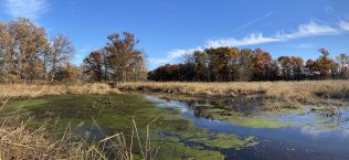
The Heinze Big Slough Project is a wetland mitigation site, that has been designed and constructed as part of the Wisconsin Wetland Conservation Trust (WWCT) In-Lieu Fee (ILF) Program, which is sponsored by the Wisconsin Department of Natural Resources. The site is located along floodplain and flood-prone areas of an Unnamed Tributary to Big Slough located northwest of Portage in Columbia County, Wisconsin. The project is located in the southwestern portion of the Upper Fox River watershed and within the Fox ILF Service Area of the Lake Michigan Basin. More specifically, the Site is within Big Slough watershed of Neenah Creek, and lies within two privately owned parcels of approximately 80 acres. The owners acknowledged interest in using the surface of the property for wetland mitigation through the ILF Mitigation Program.
The project permanently restored and protected approximately 45 acres of wetland resources. GAI led efforts through all phases of site development which included conceptual plan development, baseline data collection and environmental resource delineation, topographic survey, installation of groundwater monitoring wells, conducting of hydrology, soil, and vegetation surveys, design, including hydrologic and hydraulic analysis to support development in a Federal Emergency Management Agency (FEMA) delineated floodway, water budget analysis and hydrologic assessments, permitting at the local, state, and federal levels, construction bid support, construction observation, and site maintenance and monitoring.
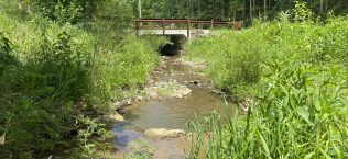
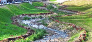
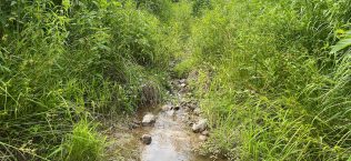
The design included dismantling of existing drainage tiles to provide hydrologic uplift to re-establishment and rehabilitation areas which were previously farmland, bank excavation to spread previously channelized surface flows to the site without flooding adjacent properties, filling of ditches previously used for irrigation, and excavation of high areas in the topography. Construction plan sheets were prepared to show areas of earthwork and the proposed design measures, erosion and sediment control placement, and seeding and planting areas. The design resulted in a combination of wetland re-establishment, rehabilitation, enhancement, and buffer area creation which is anticipated to generate approximately 30 mitigation credits for the program which will be released as performance standards are met. In the coming months, GAI will conduct the as-built status survey and proceed to conduct annual maintenance and monitoring, following through project closure.